Sonardyne and Wavefront Systems have leveraged the Solstice MAS™ (Multi-Aperture Sonar) and a SPRINT-Nav Mini to collect sonar data on seagrass beds in Plymouth Sound.
Seagrass beds are vital ecosystems that deliver numerous ecological benefits. These underwater meadows provide essential habitats for a wide variety of marine species.
Additionally, they act as natural carbon sinks, contributing to the reduction of climate change impacts. By serving as nurseries, seagrass beds offer protection and ample food supplies for many young fish species. Their root systems play a crucial role in stabilizing the seabed, mitigating coastal erosion, and improving water quality by trapping sediments and nutrients.
Despite their significance, traditional methods for locating and monitoring seagrass beds present considerable obstacles. These challenges are particularly pronounced in shallow waters where seagrass thrives. The large size and limited maneuverability of conventional survey boats make it difficult to access areas near the shore, often leading to incomplete or inaccurate data collection.
Furthermore, these methods are time-consuming and labor-intensive, frequently requiring repeated trips and extensive manual effort. Poor visibility in shallow, turbid waters adds another layer of complexity, potentially underestimating seagrass coverage.
A Technological Solution
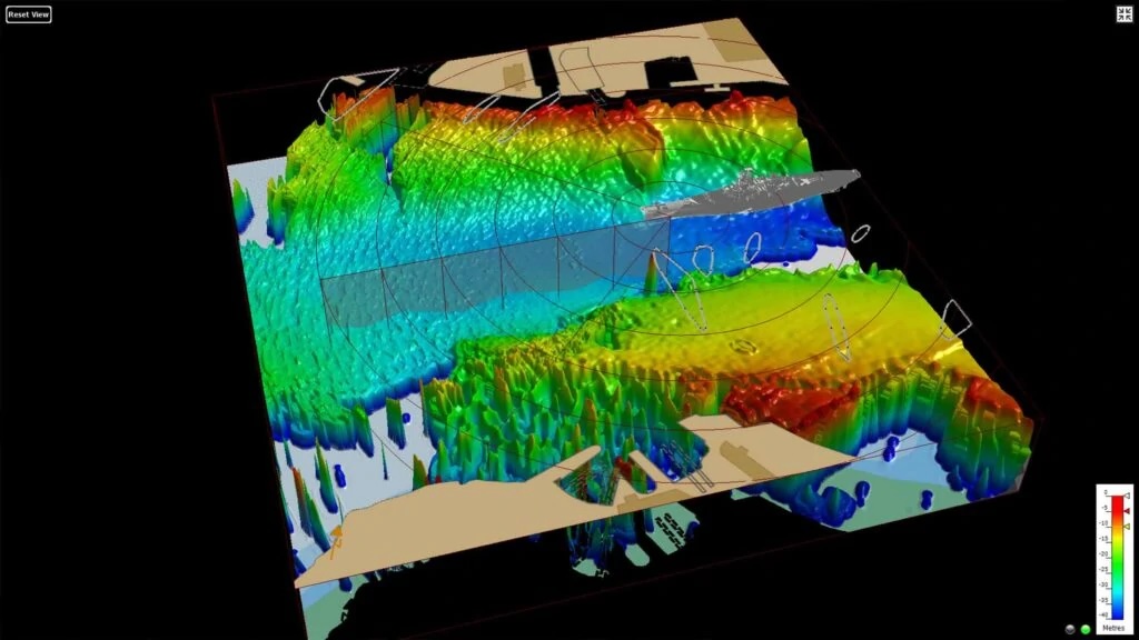
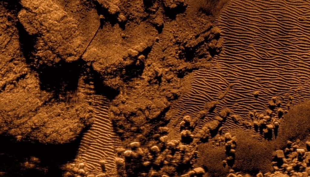
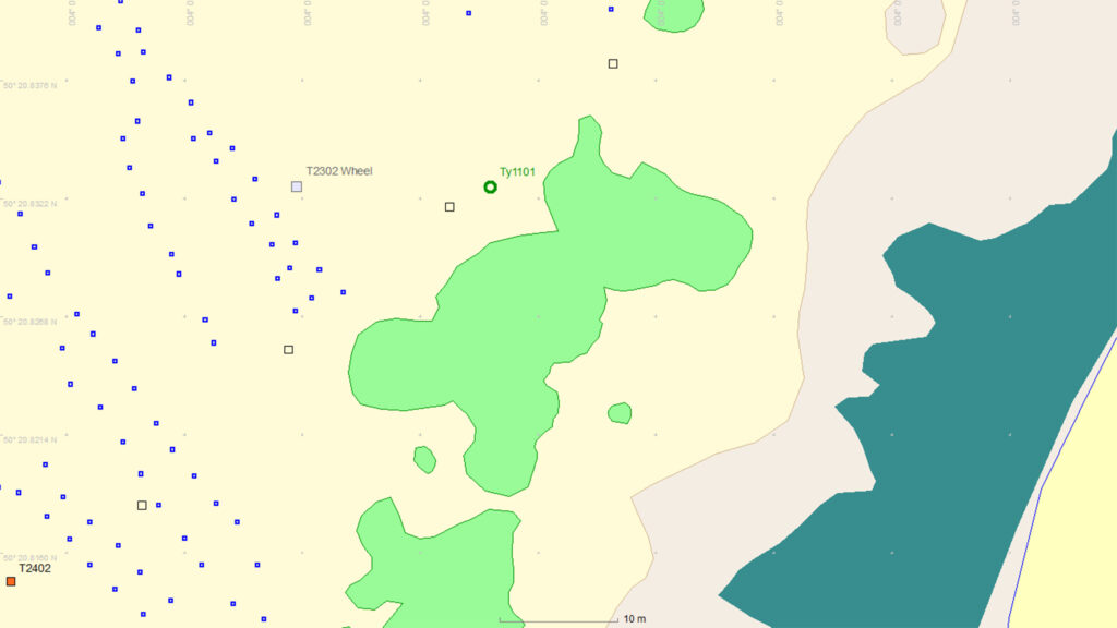
Sonardyne and Wavefront Systems offer an innovative solution to these challenges. Their approach utilizes a survey boat equipped with the Solstice MAS and a SPRINT-Nav Mini mounted on a pole. The system maps areas in strips up to 200 meters wide, capturing sonar data that is then processed into a geographic information system (GIS) map of the seagrass.
After the initial survey, a remotely operated vehicle (ROV) is deployed to verify seabed features identified by the Solstice MAS. The ROV, also fitted with SPRINT-Nav Mini, is guided using the sonar map to specific features and records video footage that can be used to generate 3D models of the seabed.
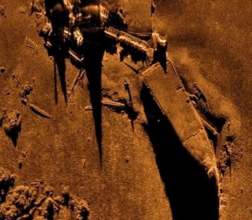
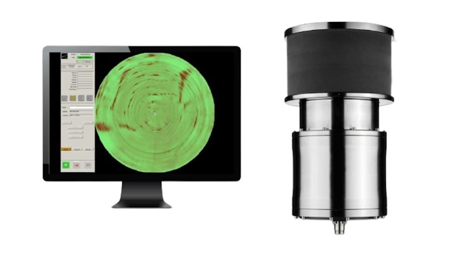
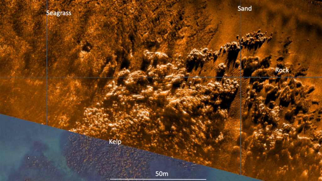
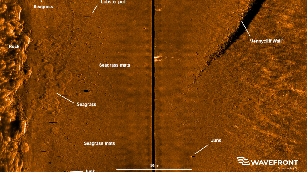
Wavefront Systems’ Solstice MAS employs sound waves to produce detailed, high-resolution images of the seabed, even in shallow environments. Its energy-efficient design bridges the gap between simple, low-resolution side-scan sonars and more expensive, data-intensive Synthetic Aperture Sonars (SAS). Solstice MAS pairs with SPRINT-Nav Mini, a compact guidance and navigation tool that integrates AHRS, Doppler Velocity Logger (DVL), Inertial Navigation System (INS), and a depth sensor into a single unit.
Enhanced Monitoring & Restoration Efforts
The combination of these technologies allows for high-quality survey data collection in shallow waters, revolutionizing habitat mapping. The collaboration between Sonardyne and Wavefront Systems, under the Covelya Group, ensures highly accurate mapping of seagrass beds.
The Ocean Conservation Trust (OCT) is leveraging this technology in a restoration initiative within Plymouth Sound. As part of their efforts, seagrass mats are being placed on the seabed to expand existing seagrass habitats.
A survey boat equipped with Solstice and SPRINT-Nav Mini, followed by an ROV with SPRINT-Nav Mini, maps and monitors the placement of these mats, providing critical insights into the project’s success.
Collaborative Innovation
Phil Hart, VP of Integrated Technology, Covelya Group, commented, “Collaboration is key to our success as a business as we strive to offer integrated solutions to key markets and applications. Our operating companies run independently. However, the overall value when they come together can be significantly more than the sum of their parts.
“Coupling Wavefront’s Solstice multi-aperture sonar with high performance inertial navigation solutions from Sonardyne and applying it to significant sustainability initiatives such as mapping and monitoring the extent of seagrass beds on the South coast of the UK, makes the effort all the more worthwhile. Great job by the team, continuously innovating to realise increased efficiency and higher value datasets for such worthwhile causes.”
Peter Holt, Marine habitat monitoring applications specialist, Sonardyne, added, “We use Wavefront’s Solstice multi-aperture sonar to map seagrass because it provides high-resolution images out to 100m on each side of the vessel even in shallow water. The sonar images give us both a broad and detailed view of marine habitats which is hard to create using other methods.
“Solstice produces reliable and repeatable results so is ideal for measuring and monitoring changes to the seabed. Solstice also requires very little processing and is compatible with standard side scan processing software, so we find it an efficient solution for habitat mapping over large areas.”
By integrating advanced sonar and navigation technology, the future of seagrass bed mapping and restoration in Plymouth Sound is taking a significant step forward.