Discover World-Leading Technologies for Ocean Science
Discover cutting-edge solutions from leading global suppliers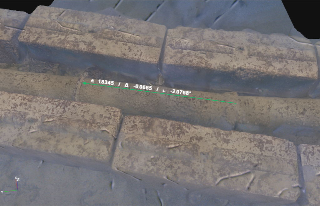
Voyis technology was deployed as part of a multi-sensor inspection strategy used by Coastal Sensing, a hydrographic and marine geospatial services company specializing in high-resolution data collection across coastal, offshore, and inland water environments. Read more >>
The project focused on the creation of a high-resolution, georeferenced 3D model of an armored pipeline located between Mercer Island and Bellevue in Lake Washington, demonstrating how advanced optical imaging can support the inspection of critical underwater infrastructure.
To address the challenges associated with low-visibility conditions, complex pipeline geometry, and the need for precise spatial positioning, Coastal Sensing combined forward looking sonar (FLS) with the Voyis Discovery Stereo Inspection Series. The survey collected more than 38,000 paired stereo images, along with high-frequency positional (XYZ) data and sonar datasets used for contextual mapping and feature identification. This integrated approach provided both broad-area situational awareness and the detailed visual information required for comprehensive asset assessment.
At the core of the project was the Discovery Stereo I-Series, which enabled the creation of a dense, high-resolution 3D photogrammetry model suitable for detailed inspection and quantitative analysis. Leveraging true stereo vision, the system captured paired imagery synchronized with positional data to produce a metrically accurate reconstruction of the pipeline. The resulting model supports reliable dimensional measurements directly from the dataset, while BV-certified sub-millimeter measurement accuracy provides confidence for detailed inspection activities. In addition, synchronized off-axis strobe lighting helped reduce backscatter and improve image quality in challenging underwater conditions.
The project demonstrates the value of combining sonar and optical imaging technologies during subsea inspections. While sonar supports navigation and target detection in low-visibility environments, optical imaging delivers the resolution necessary for detailed condition assessment. Together, these complementary datasets provide a comprehensive understanding of both the surrounding environment and asset condition.
Read the full case study to learn how Coastal Sensing applied this multi-sensor methodology to generate a survey-grade digital twin and support repeatable inspections and change detection over time.