
Multibeam Echosounders
Discover cutting-edge solutions from 8 leading global suppliers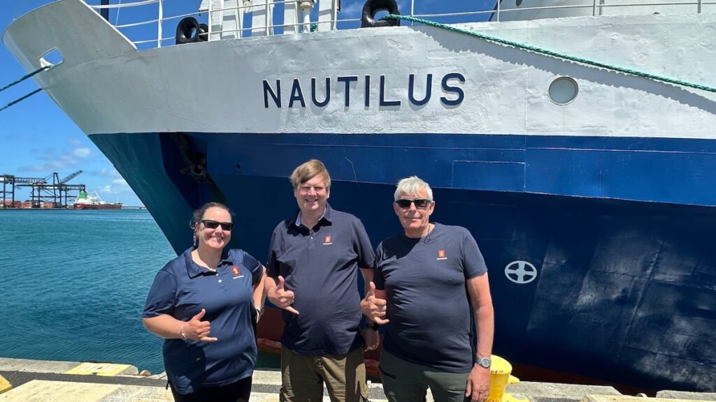
KONGSBERG and the Ocean Exploration Trust have launched a 14-day expedition in the Central Pacific to map vast areas of unexplored deep ocean seafloor using advanced multibeam sonar technology.
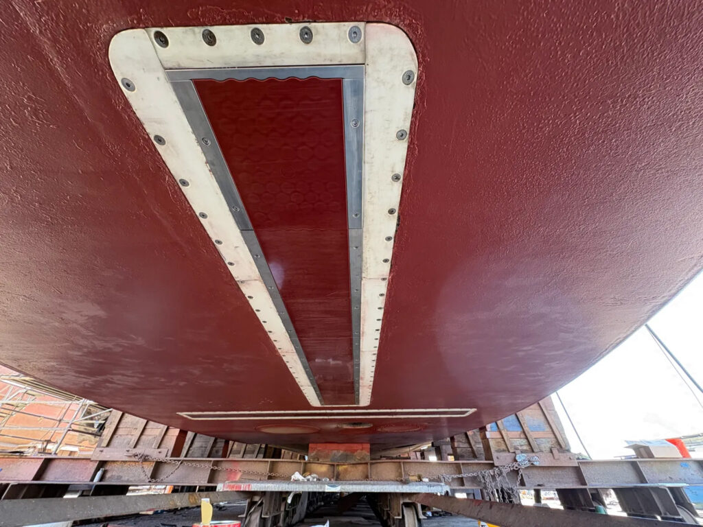
The Pacific Mapping expedition, running from June 10 to June 24, 2026, marks the first operational deployment of KONGSBERG’s EM 304 MKII multibeam echo sounder aboard the exploration vessel Nautilus. Three KONGSBERG engineers are embedded on the vessel for the duration of the mission, utilizing the cruise as a real-world testing platform to advance multibeam technology and elevate global mapping standards. Funded through a wider upgrade supported by the United States Navy’s Office of Naval Research, the initiative represents a close collaboration between industry, research organizations, and funding bodies.
While the ocean covers more than 70 percent of the planet, high-resolution charts for deep ocean environments remain limited due to access, cost, and technical constraints. The EM 304 MKII is engineered to operate at full ocean depth, combining wide swath coverage with high resolution to allow survey teams to map larger areas efficiently without sacrificing data quality. For the Ocean Exploration Trust, this system is expected to double the surveyable area compared to previous equipment, minimizing both time and operational costs in remote environments.
Derek Sowers, Mapping Manager, Ocean Exploration Trust, explains, “The EM 304 MKII is optimised for features of interest we tend to explore, like complex canyons, seamounts, ridges, trenches, seafloor spreading centres, and subsea volcanoes. It allows us to map and reveal these amazing features in greater detail and sets us up for success for further exploration using our ROVs and other assets.”
The expedition provides an operational testbed for generating live datasets across diverse seabed environments, allowing engineers to optimize hardware performance and software functionality. The vessel also hosts an integrated mapping internship on every cruise, offering the engineering team a distinct opportunity to observe how first-time users interact with the system software.
Colleen Peters, Product Manager Mapping Software, KONGSBERG, explains, “We can simulate many configurations in the lab and on our test vessels, but not the realities of deep-water surveying. That is why it is essential to test in the same conditions our customers work in, so we can confirm new features perform as intended. Nautilus is an ideal platform for system testing because the team is committed to pushing new technology forward. It also runs an integrated mapping internship on every cruise, giving us a rare chance to see how first-time users interact with the software.”
Founded in 2007 by Dr. Robert Ballard, the Ocean Exploration Trust makes all scientific data from its expeditions publicly available to researchers, governments, and communities worldwide. The 2026 expeditions are sponsored by NOAA Ocean Exploration through the Ocean Exploration Cooperative Institute, alongside partners including LeeWay Marine, Flying Fish, the National Center for Education & the Economy, QPS, and the Phillip Stephenson Foundation.
Colleen Peters, Product Manager Mapping Software, KONGSBERG, continues, “As ocean industries continue to expand, the need for reliable seabed data keeps growing. Seafloor mapping supports everything from research and environmental monitoring to subsea infrastructure and better-informed policies. The EM304 MKII helps meet that need with full-ocean-depth capability, broad coverage and high-quality data. We’re looking forward to showing what it can do onboard Nautilus with OET on its first mapping expedition since the upgrade.”