Discover World-Leading Technologies for Ocean Science
Discover cutting-edge solutions from leading global suppliers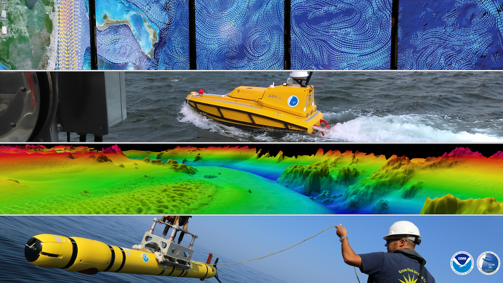
NOAA and the University of New Hampshire (UNH) are expanding a 24-year ocean and Great Lakes mapping partnership.
This expansion involves the creation of a new Center of Excellence for Operational Ocean and Great Lakes Mapping.
The Center of Excellence is being funded through $10 million in NOAA’s FY 2023 budget, and will complement existing research, technical expertise and advanced educational programs at the NOAA-UNH Joint Hydrographic Center and UNH’s Center for Coastal Ocean Mapping.
The Center of Excellence will focus on the following priorities:
- Delivering practical hydrographic training and fostering workforce development for ocean mapping operations.
- Providing technical expertise and systems support for NOAA’s mapping operations on an increasingly diverse set of platforms, including new ships and uncrewed survey vessels.
- Partnering with academia and industry to transition ocean mapping research to operations.
A portion of the funding will be used by UNH to construct a new, state-of-the-art ocean mapping facility that will serve as the focal point of a campus innovation hub to bring together academia, industry and government.
The new facility will include office and instructional space, as well as a large, high-ceiling area with overhead cranes — known as a high bay — for storing, outfitting and staging bulky equipment and small vessels.
Upon completion, the facility would provide a shared space for collaboration between NOAA staff from the Joint Hydrographic Center and Center of Excellence, UNH faculty and staff and ocean industry partners.
Ocean mapping data is the basis for researching, exploring and characterizing the USA’s ocean, coasts and Great Lakes in order to support maritime commerce, transportation and emergency response activities.
Ocean and Great Lakes mapping provides foundational data for a wide range of key NOAA priorities, including modeling and forecasting water levels, currents, storm surge and tsunami inundation; fisheries habitat identification; marine protected area site selection and management; and environmentally sound offshore energy development.
“Accurate and up-to-date maps of our ocean, coasts and Great Lakes are critical to maritime commerce, transportation and recreation, and directly support resilient coastal communities,” said Nicole LeBoeuf, director of NOAA’s National Ocean Service.
“NOAA and UNH have a long history of collaborating to advance the latest technologies and tools to map our ocean, coasts and Great Lakes — a cornerstone of the blue economy,” said Rick Spinrad, Ph.D., NOAA Administrator. “Our continued partnership on the Center of Excellence will help build a workforce ready to tackle the mapping challenges of the future, and further our understanding of our changing ocean and coasts.”
“The Center of Excellence will build upon our decades-long partnership with NOAA, as well as grow the critical research field of ocean and Great Lakes mapping, where we can engage with industry leaders to develop and train the next generation of mappers,” said Marian McCord, senior vice provost for research, economic engagement and outreach at the University of New Hampshire. “NOAA will anchor UNH’s new mixed-use complex, The Edge, which will be the core of activity for faculty, students, industry and government to come together, share ideas and execute cutting-edge concepts. This breeding ground for innovation and invention will be a key player in providing economic growth for the town of Durham and growing the workforce in the state of New Hampshire.”