Discover World-Leading Technologies for Ocean Science
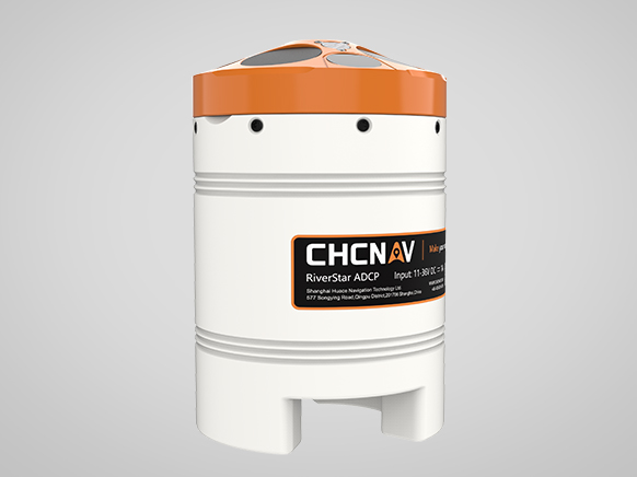
Discover cutting-edge solutions from leading global suppliersCHC Navigation has announced the release of the RiverStar 3600D, a compact Acoustic Doppler Current Profiler (ADCP) engineered for high-precision current measurement in diverse inland water environments.
The RiverStar 3600D (RS3600D) utilizes an intelligent dual-frequency system to maintain consistent profiling across varying depths. By coordinating an ultra-high frequency 3600 kHz channel with a 1200 kHz band, the instrument allows operators to adapt to specific site conditions without the need for multiple devices.
In shallow or slow-moving water, the high-frequency mode is capable of measuring flow velocities as low as 1 cm/s and reduces the near-surface blind zone to just 5 cm. This design choice targets common industry challenges where signal noise and limited surface data often hinder conventional profilers.
To enhance depth measurement accuracy, the RS3600D incorporates a 9-beam configuration that includes a dedicated 600 kHz vertical beam. This setup enables the simultaneous acquisition of velocity and depth data, facilitating efficient bathymetric studies and river cross-section surveying. The system supports a depth measurement range of up to 100 meters and features improved bottom tracking performance, providing the high-fidelity data required for complex hydrology and river engineering projects.
The hardware is designed for significant field mobility, weighing 2 kg with a diameter of 12 cm. This compact form factor allows for flexible deployment across various platforms. The RS3600D is compatible with Unmanned Surface Vessels (USVs), such as the CHCNAV APACHE 4 series, as well as channel buoys, cableway towing systems, and trimarans. This versatility ensures the tool can be used for both rapid spot measurements and long-term monitoring campaigns depending on the operational constraints of the survey.
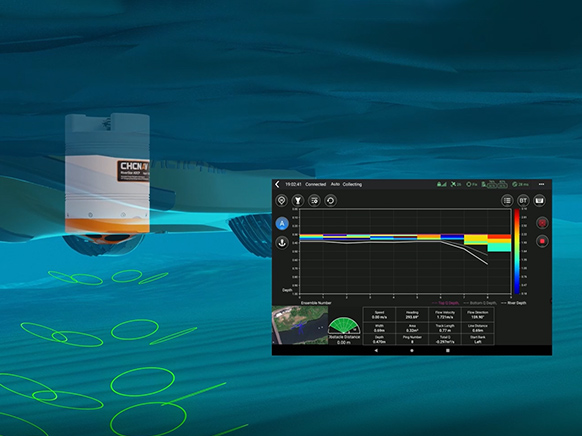
The technical workflow is supported by a suite of integrated software tools designed for end-to-end management. Field control and file transfers are handled via the EasySail Android application, while the HydroProfiler PC software manages post-processing, reporting, and long-term data archival.
As a global provider of geospatial solutions, CHC Navigation has positioned the RS3600D to support a wide array of applications, including ecological flow monitoring, river discharge measurement, and channel mapping.